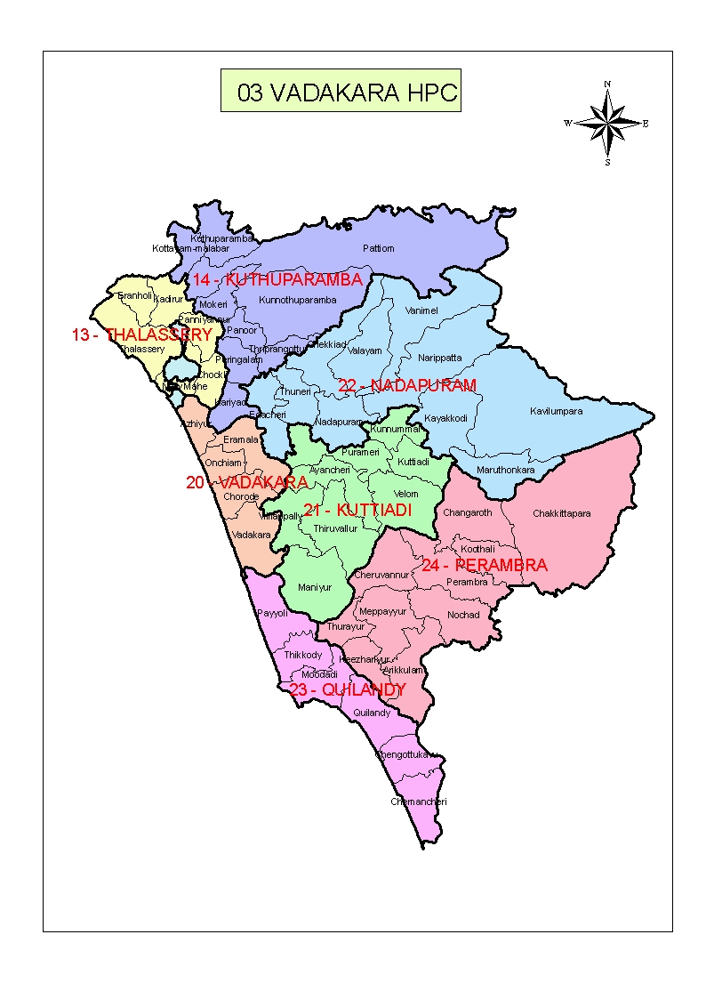
WEB GIS FOR VADAKARA MUNICIPALITY
Vatakara is located at 11.60°N 75.58°E and has an average elevation of 15 m (49 ft). It is situated about 49 km to the north of Kozhikode City, approximately 44 km to the south of Kannur City, and adjacent to Mahé. The town lies by the side of a river variously called the Moorad river, the Kuttiady river, or Kottakkal river. The town's position relative to this river led to it being called Vadakkekara (north bank), later contracted to Vatakara. Towards the east, near the panchayats of Nadapuram and Kuttiady, Vadakara borders the Wayanad district along the Western Ghats section. In the west, like many of the towns in Kerala, Vatakara is flanked by the Arabian Sea. The Kuttiyadi river meets the sea to the south of Vatakara, forming small islands and sandbars near the river mouth.
Web GIS provides a browser based access to spatial information preserving the inherent nature of GIS data model (vector/raster) such as scale, coordinate systems, geometry and attributes while completely safeguarding the original data as such. That means the user will have access to the data for viewing and querying, but will not have the physical access to the data. This is further explained in the Web GIS model of interactive portrayal (Doyle, 1999). This model helps to analyze the various stages of information flow in Web GIS applications. This model suggests different stages of Web GIS; information selection, transformation and presentation. In the final stage the user is sees an image of the requested data.